Overview
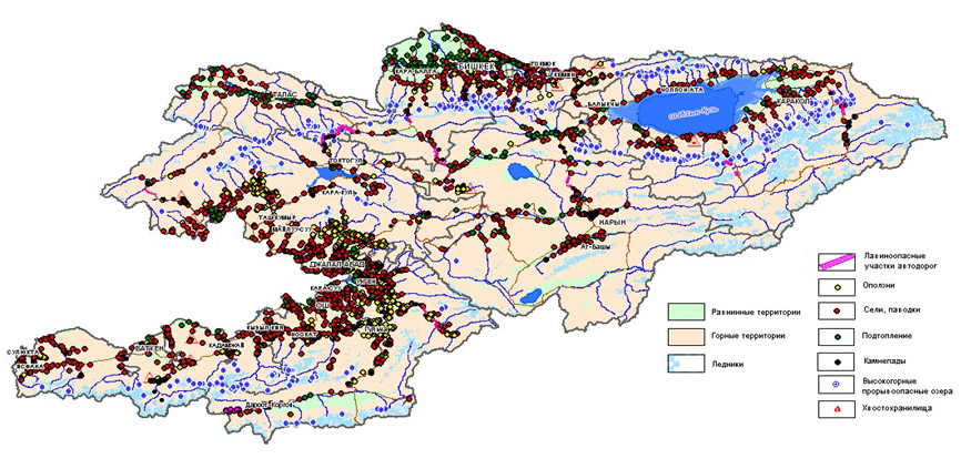
The tectonic activity of the Tian Shan and the Pamir-Alai mounting systems is one of the main causes of the emergence of dangerous geological processes and phenomena. The mentioned mountain systems have a strongly dissected relief, a complex geological structure, and a modern active tectonics. This creates favorable conditions for the development of exogenous geological processes: landslides, mudflows, erosive activity of rivers, flooding with high groundwater level, flooding, rock fall, formation of break-through outburst lakes in the highland belt, and many others. The interdependence or synergetics of natural processes lead to the emergence of several genetically different hazardous natural processes at the same time, and, consequently, increases the risks.
The climate of Kyrgyzstan is determined by its geographical location in the center of the Eurasian continent, as well as with high mountain systems of Tien Shan and Pamir-Alai. Therefore, the climate is sharply continental, with a lot of mainly precipitation in the autumn-winter and spring periods. These main factors lead to the emergence of natural hazards associated with geological and climatic processes that damage lead risks to the population, the economy of mountainous countries and lead to the death of people.
During the field excursion, we will get acquainted with monitoring and forecasting the activation of dangerous processes and phenomena in mountain and valley conditions.
We will study the basic main natural forces, as a result of which there are natural hazards of different genesis.
Geological Expedition Program and Route
This expedition is useful for young specialists or scientists who have already received theoretical ideas knowledge about the natural dangers that arise in the Asian mountain countries. In During the expedition you can see the results of processes, as well as understand the conditions, causes and patterns of their formation in natural conditions. Many foothill areas of the Tian Shan, is an ideal natural testing ground, where it is possible to conduct scientific and applied research and make an assessment of the risks associated with these or those dangerous natural processes. Most importantly, the participants of the training expedition will be able to make forecasts and understand the causes of the emergence of dangerous geological processes and phenomena.
A field geological expedition is an opportunity to study natural hazards. During the field excursions we will be able to use modern methods, to interpret the results of remote sensing, to analyze the results of interpretation of space images and field observations, to calibrate mathematical and computer models of dangerous geological processes and to make their prediction.
The participants of the expedition will be able to learn how to use the methods of determining the zones of damage by dangerous processes, and also to assess damage risks and vulnerability as a result of the occurrence of a dangerous geological process.
During the expedition, we will study the factors, conditions that affect the occurrence of dangerous geological processes. For example, such as tectonics, geomorphology, meteorological conditions, hydrogeology.
The expedition includes field routes, practical methods of study, as well as seminars.
The route of the expedition passes through the Northern Tian Shan, the Middle Tian Shan and the Pamir-Alai. During the excursions we will be able to:
- – Explore the zones of formation of landslides and mudflows,
- – Areas of flooding with groundwaters in intermontane valleys,
- – We will conduct a survey of coastal soil erosion on by mountain rivers.
- – We will investigate the reasons causes of the formation of large landslides and a catastrophic regional rise of the groundwater level.
- – Genesis of loessial rocks sediments in which dangerous landslides are formed;
- – We will study the types of landslide processes and the stages phases of their formation;
- – Consider the necessary monitoring systems for hazardous geological processes.
- – Study the signs of active tectonics
- – Explore the mudflow valleys
- – Define the zones of damage by dangerous processes and the degree of risks
Day 1. Arrival in Bishkek
All participants will be met at the airport.
Hotel accommodation
Day 2. Excursion to Ala-Archa. Investigation of tectonic structures.
In the morning we will go to study the border of the connection of the Kirghiz Kyrgyz ridge with the Chui basin valley. This boundary called as “Issyk-Ata” fault. Observation point 1. Further excursion to the national park Ala-Archa and Excursion to Chon-Kurchak canyon.
Return to the hotel.
In the evening, presentation of the expedition program, acquaintance with the geology of the Tian Shan.
The presentation will take place in the conference hall of the hotel. Theme of the presentation-seminar: Natural and man-made hazards of the Tian Shan and Pamir-Alai
Acquaintance with experts.
Day 3. Bishkek – Boom Gorge – Kochkor – Naryn.
In the morning our expedition starts on the route, which is directed to the east to the Issyk-Kul lake valley. On the way, a survey of coastal river bank erosion on the Chu river. Observation point 2. Causes of erosion of riversides. Methods of stopping coastal river bank erosion and strengthening the shores banks. On the way visit the historical museum of Burana – the ancient empire of Karakhanids – IX-XII centuries.
Next, Observation point 3, a mudflow dam in the mouth of the Konorchok gorge. Along the way, the study of landslides and debris in the Boom gorge. Prevention of landslides and rockfalls. Measures to protect the railway and road from scree, rock falls and rockfalls. Observation place 4, Kok-Moynok. Tectonic boundary. Violations in the layers of lake deposits of Toguz-Bulak, Kok-Moynok depression – paleo-gulf of Issyk-Kul lake in the Middle Pleistocene (N2). Signs of the influence of quaternary tectonic activity on the interior of the Issyk-Kul basin.
Lunch in the Balykchi city. Transfer to the city of Naryn. Hotel accommodation.
Day 4. Field excursions around the Naryn city
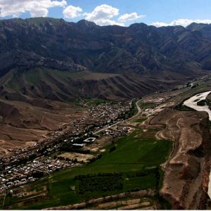
The city of Naryn is located in a mountainous area at an altitude of more than 2000 m. Naryn is located laying in the narrow floodplain of the same name river of the same name and surrounded by mountains. The scarcity of land, limits the local population in active and safe construction. Therefore, personal houses and municipal buildings are located in the risk zones, which arises from dangerous geological processes. Such a neighborhood of the city and dangerous natural processes, creates high risks of damage from natural geological processes. These conditions make the city very vulnerable in face of natural hazards
Naryn is surrounded by about 80 mudflow valleys, where 50 percent of them, according to experts, are dangerous. On the slopes of the mountains, as well as in the valley, measures are being taken to protect the territory of the city. But, a limited space for the construction of protective structures, makes use of non-standard solutions and projects to protect the public.
In addition to the mudflow threat, some urban sites are threatened by landslides and rock falls. Until now, experts and local authorities are looking for effective solutions to protect the city.
Excursion along the southern slopes of the mountains, adjacent to the city. Study of the mudflow valleys, the Observation point 5. Excursion along the northern slopes of the mountains adjacent to the city. Study of mudflow valleys, other genesis, place of observation 6. Description of mudflow valleys. Determination of the genesis of mudflows. Definition of zones of mudflow defeat. Observation site 7, the study of the causes of rockfalls threatening the road leading into the city.
After lunch, a trip to the confluence of the Greater Naryn and Little Naryn. Observation point 8. Study of active tectonic faults. Further studies of the aqueducts of the Great Naryn Canal. The threat of breakthrough of the channel Canal as a result of mudflows and flooding of residential areas. Ice phenomena in the city. Observation point 9. In the evening, a seminar on the topic: Preliminary assessment of risks and vulnerabilities. Overnight at hotel in Naryn.
Day 5. Naryn – Baetovo – Ugut – Kazarman
In the morning departure from Naryn towards the high-mountainous Baetov village to the west along the Naryn river. On the way, study neotectonic morphostructural formations that form a modern relief.
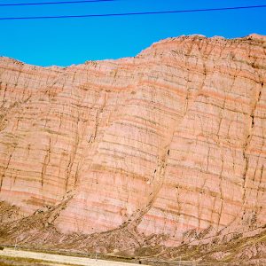
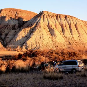
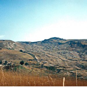
After Baetovo, the route runs through the badlands forming the terrace. In some places, the accumulative cover is destroyed, as a result, the surface of the terraces becomes erosive. Because of erosion, the relief has a typical wavy appearance. All these forms of relief, indicate the latest tectonic vertical movements. In the Inner Tian Shan, this morphostructural complex forms a relief of the “badlands” type. Deep river valleys in turn formed a wide development of socle terraces.
Observation point 10. Here we will stop to study the lake sediments of the paleo-lake, which migrated during the Alpine folding orogeny through the weakened morphostructural zone, to the Ferghana valley between the modern Fergana and At-Aynok mountain ranges. Paleo-lake left behind a powerful heavy lake deposits, which today form badlands.
The absence of landslides confirms that there are no loess accumulations in the inner Tian Shan. While in southwestern Kyrgyzstan in the foothills of the Pamir-Alay, loess deposits are very widespread.
Further, the route to the Uhut village along the Zhaman-Davan river, where the annual migration of the riverbed meandering occurs, the observation point 11.
Then the route through the gold mine Makmal and further to the settlement Kazarman. Accommodation in the guest house Kazarman.
Day 6. Kazarman – Kara-Alma – Jalal-Abad settlement
In the morning the route continues to the south-western part of Kyrgyzstan, through the Fergana Range, by relict walnut trees in the Kara-Alma tract. Arrival in Jalal-Abad. Accommodation in a guest house.
Day 7. Exploring landslides in the vicinity of the Jalal-Abad city
In the morning, excursion to the Kok-Jangak city. Study of genetic types of landslides. Some landslides arose as a result of the development of coal mines, the observation point12. Landslides in loess sediments, the linkage of the formation of landslides with tectonic faults and the level of groundwater.
In the evening, a field seminar on the topic: The theory of the origin of the loess – genesis. Overnight in a guest house in Jalal-Abad.
Day 8. Geological excursion to the valley of the Kara-Unkur river
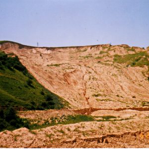
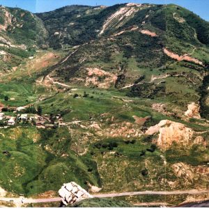
In the morning excursion to the valley of the Kara-Unkur river (50 km from Jalal-Abad). Observation point 13. The river begins from the southwestern slopes of the Fergana range. The catchment area is about 1300 km2. The upper part of the river is cut by Paleozoic rock rocks and forms narrow canyons. After the confluence of the Kara-Unkur river with the Kyzyl-Unkur river, the river valley becomes wide. The banks of the valley are composed of meso-cenozoic (Mz-Kz) sediments. Above lie loamy loams, up to 20 m thick. The right slope is composed of Pliocene-Quaternary (N2-Q1) sediments and Paleogene-Neogene deposits (P2-N1). The left slope of the valley, at a distance of about 15 km, is struck by ancient large and numerous modern landslides. Due to the landslide danger in 1988, 6 villages were relocated to a safe place.
Here, there are landslides, which are formed in loess rocks. Almost all large landslides during the movement capture the lower lying rocks of the Mesozoic, which are involved in the displacement: rocks of Paleogene (P), Cretaceous (K), Jurassic (J). Three large landslides, formed in loess rocks, which lie on the Paleozoic rocks (Pz).
The main factors of landslide development are atmospheric precipitation, groundwater, joint influence of atmospheric precipitation and groundwater OVERGRAZING. Some landslides, can block rivers, roads and today they threaten residential buildings.
Excursion along the left bank of valley of the Kara-Unkur river, Observation point 14. Large ancient landslides are formed here. Their activity began in 1969, when there was a lot of precipitation.
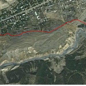
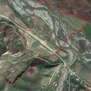
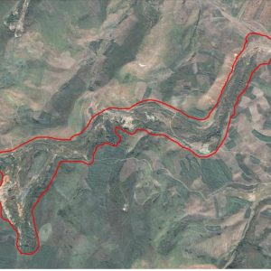
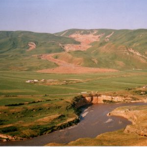
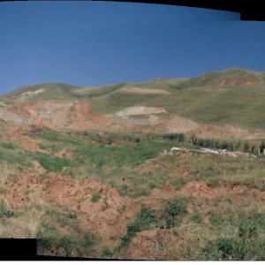
The largest landslide near the Kara-Kol village. Almost near the watershed there is a zone of origin of the landslide. The height of the main wall of the origin of the landslide is 20 meters. The frontal part of the landslide is on the opposite bank of the Kara-Unkur river, a space image 1. At present, this site is dangerous. The ancient landslide is in an active state.
Return to the guest house in Jalal-Abad.
In the evening a seminar on the topic:
– Classification of landslides. Almost all classification types of landslides are described in Kyrgyzstan. The largest landslides in Kyrgyzstan were formed as a result of the influence of groundwater, which play a major role in the formation of large landslides.
– On some landslides, continuous monitoring of the level of groundwater was conducted. Unfortunately, at present the work of observation wells has been stopped due to a lack of financial resources.
– Studies have shown that at present the regional level of groundwater is continuously rising. Previously, in representative landslides, geologists conducted continuous monitoring of the dynamics of groundwater.
Day 9. Geological excursion to the valley of the Kugart river
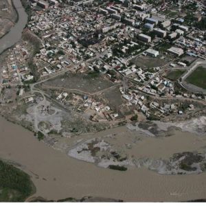
In the morning excursion to the valley of the Kugart river. Kugart is a wide alluvial-proluvial valley, which is a paleo-channel of the Naryn river. This is evidenced by the powerful strata of alluvium and proluvium in the wide floodplain of the river. Geologists suggest that the ancient Naryn flowed from the paleo lake, where we spent the previous excursion to Baetovo. In the spring, the Kugart river is dangerous. Its waters can flood numerous villages that are located next to the riverbed. The river bed is located above the surface where the villages are located. The banks of the river are protected by dams along the coast. In 1998, a catastrophe occurred when, during the spring flood, the right bank dam broke. Thousands of houses were flooded. Observation point 15, protective dam on the Kugart river.
In the valley of the river there are many dangerous landslides, which can block the side rivers and form dangerous lakes. More than 500 landslides are known in the valley. Landslides are formed in loessial rocks. But almost all landslides capture the underlying rocks. This Pliocene is an ancient Quaternary (N2-Q1) sediment. In the valley there are landslides, which involve the movement of the Paleogene layers, layers of Cretaceous age, as well as Paleozoic rocks. The bulk of landslides were formed under the influence of atmospheric precipitation. Large landslides were formed under the influence of groundwater.
In the valley of the Kugart river, all landslides differ from each other in geological and structural features, morphology and causes of occurrence. Basically, in the displacement, loessic rocks are involved, whose thickness reaches 20 m.
The bulk of modern landslides occur on the surface of ancient landslides. These landslides are large, some have already reached the watershed.
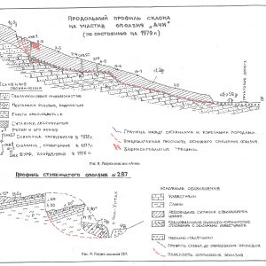
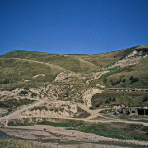
Some landslides have a unique structure (Fig. 9), which is not found anywhere else in Asia, observation point16. Groundwater plays the main role in the formation of landslides.
Landslips of the Kugart’s valley are unique geological indicators, global natural changes that occur both in the Earth’s crust and in the atmosphere. These are global geological processes associated with tectonics and global processes associated with climate.
Return to the guest house.
Day 10. Transfer to Osh
In the morning, the route continues to the ancient Osh city. On the way visit the oldest resort in the Jalal-Abad city, observation point 17. Field lecture on medicinal thermomineral waters. Further, on the way to Uzgen, visiting the historical and architectural complex of the Karakhanid dynasty period, IX-XII centuries.
On the route, in the Sawai village, study of the flooding zone as a result of rising groundwater level, the observation point18. Causes of flooding. Drainage system. Long-term forecast.
Arrival in Osh. Accommodation in a guest house. In the evening Seminar on the topic: Dependence of the origin of landslides on the geological structure. Deciphering of space images. Study landslides using GIS-methods. Overnight in a guest house in Osh.
Day 11. Excursion to Kara-Kulja district
Studying of modern landslides, which were formed on the body of ancient landslides. Landslides with a volume of about 3 million\m3, the observation point19.
Experts suggest that the occurrence of landslides has a natural cyclic pattern. In 2004, after heavy precipitation, new huge landslides on the river Kara-Guz began to occur. Next, an excursion to the Sary-Bulak village. Study of landslides in the Tar river valley, the o observation point 20. All modern landslides in this area occur on the body of ancient landslides. On ancient landslides, houses and whole villages were built. Activation led to disasters.
Return to Osh. On the way, the study of landslides in villages Kolduk, Komsomol, Myrza-Aki, observation points 21, 22, 23. Return to the guest house. In the evening, a seminar on: Genetic types of landslides in Kyrgyzstan. Rest in a guest house in Osh.
Day 12. Excursion to landslides in the valleys of the rivers Uzgen.
Study of landslides in the valley of Jalpak-Tash, Uzgen district. Observation point 24, landslide 2016. Further, an excursion to the Kurshab landslide zone. Observation point 25. In April 1988, an area of 1.5 km2 formed a landslide of about 5 million m3. The landslide captured the watershed of the slope. The resulting landslide-flow, during the movement made its way along the creek, during the first two days it crawled about 5 km.
After 5 days, its length was 9.5 km. The dwelling houses in the valley had time to be evacuated. The width of the landslide flow is from 50 to 100 meters, the thickness of the landslide mass is from 3 to 10 meters. As a result of the landslide, 2 lakes with an area of 30 and 50 m2 appeared on his body. In 2002, the landslide began to move again, killing 50 people.
In 2003, near the Kolduk village, a landslide-stream, 800-900 meters long, with a width of 550 meters, fell. The landslide blocked the road, the canal and the Iasi river. Landslide flow, destroyed 10 electric line supports. Fragments of the frontal part of the landslide are on the opposite bank of the Iasi River on an area of 80 x 40 m2 (space photograph No. 10).
During the excursions, it is impossible to see a large number of various landslides. But on our route we will continuously see more and more landslides. They are diverse in form and genesis. Return to Osh. Rest in the guest house.
In the evening Seminar on the topic: forecast landslide hazard. Risk assessment. Assessment of the affected area by a landslide.
Day 13. Excursion to Gulcha
In the morning we go to Gulcha, this is a small former military town located inside the mountain Kichik-Alay system, south of Osh city (90 km). On the way, a study of large landslides on the Chiyirchik pass. On the construction of the Osh-Sary-Tash road, measures were taken to protect the road from a number of landslides. Study of landslides and protective structures, the observation point26.
Then, the study of landslides in Gulcha. In the Gulcha area, there are the largest landslides. In 1988, from the left slope of the Gulcha river valley, a landslide with a volume of about 5 million\m3 fell. He destroyed the canal dam. There was a threat of flooding the city. And also, there was a threat of overlapping the Gulcha river bed and flooding the city. Urgent measures were taken to protect the city, the observation point 27.
To the south-east of Gulcha in April 2002 the movement of an ancient landslide began. Study of the huge landslide “Gulcha”, the observation point 28. Mesozoic rocks (MZ), red clays, limestones and gypsum were involved in the movement.
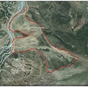
It was decided to evacuate the residents of 20 houses. A few days later, the speed of the landslide has greatly increased. Later, apartment buildings began to crumble. Within a day, a giant landslide passed a distance of about 150 meters, destroying 48 houses. Within a few days the landslide moved at a speed: in the left part – 1 m / h, in the middle – 2.5 m / h, in the right – 3.5 m / h. The volume of the landslide was about 14 million m3 (satellite image No. 7). From the danger zone, 200 families were evacuated (Figure 14).
The reasons for the occurrence of large landslides were precipitation, the norm of which exceeded 2-3 times, more than the average long-term norm. This led to an increase in groundwater levels along tectonic faults. Perhaps further movement of the landslide is possible. Currently, the landslide is under surveillance. On the landslide, there is a monitoring system.
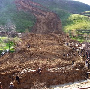
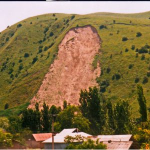
After lunch, excursion to flying landslides, to Budalyk village, a observation point29. From the left slope of the Budalyk valley near the Kainama village in April 2004, a landslide with a volume of about 0.5 million m3 emerged, which destroyed 11 residential buildings. Under the landslide, 33 people were killed. Landslide masses jumped to the opposite slope to a height of about 20 meters. The reasons for the landslide formation are groundwater level rise, after heavy precipitation and seismic shocks that occurred the day before the landslide occurred. Photo … .2
Return to Osh. Overnight at the guest house.
Day 14. Osh – Abshir-Ata – Kyzyl-Kya – Kadamjai
In the morning, a route to the Dangi canyon along the Aravan-Say River. Excursion to the place where it was necessary to build a protective dam from catastrophic mudflows along the Aravan-Say river, the observation point30. The construction of a protective dam became impossible, as karst processes are very developed in the construction area. Then the route to the Abshir-Ata gorge. In Abshir-Ata excursion to the waterfall – vaucluse.
Further, the route to Kyzyl-Kya. In Kyzyl-Kya, inspection of protective structures from mudflows, the observation point31. Lunch at a local restaurant.
Next, the route to the west in Kadamjai. Hotel accommodation.
In the evening, a seminar on the topic: Probable scenarios of flooding of Osh, Aravan village, Kyzyl-Kya city, in case of catastrophic mudflows.
Day 15. Kadamjai – Batken – Sulukta
In the morning our route continues to the west in Sulukta town. In the vicinity of the city, the study of landslides. Observation point32. About 70 landslides are formed in the Sulukta valley. Basically, these are not deep landslides. The main causes of landslide formation are atmospheric precipitation, groundwater. About 30% of landslides have already been unloaded, and the rest are at different stages of development.
From 1995 to 2002, as a result of landslides, the city suffered great damage. About 700 houses were demolished. Several times to a safe place, the railway, electric lines were transferred, water systems were destroyed. Arrival in Sulukta. Hotel accommodation. In the evening a seminar.
Day 16. Sulukta – Batken (return trip to Osh)
In the morning excursion to the coal mine. Excursion to the canyons formed in the Paleogene-Neogene (P-N) rocks. During the route to Batken and Osh, the study of river valleys and zones of destruction in the event of breakthrough high-altitude lakes, along the rivers. The most dangerous valleys with the possible occurrence of large floods caused by high-mountainous break-through lakes are: Isfayram-Say, Ak-Suu, Shakhimardan, Sokh, Karavshin-Isfara, Leilek-Ak-Suu. The most likely period of flood occurrence, as a result of the breakthrough of high-mountain lakes is July-August (early September).
Arrival in Batken. Hotel accommodation.
Day 17. Batken – Osh
On the way excursion to the old abandoned quarry on the lead deposit in the Soviet settlement. The path passes through a stony desert. Many deposits of polymetallic ores are located along the South Fergana hydrothermomineral belt. Along this geological zone, many deposits are formed. On the route, the study of flooding processes as a result of raising the groundwater level in the Caravan-Kok-Jar area, the observation point33.
At present, on the territory of Kyrgyzstan, the processes of raising groundwater levels occur in the plains of the Tien Shan and Pamir-Alai. These are the most suitable and favorable regions for living and developing agriculture (Figure 2.6).
On flooded areas in populated areas there is deformation and destruction of houses, buildings, utilities, deteriorating sanitary and hygienic conditions, increasing seismic hazard. Land degradation occurs on the farmlands (bogging and salinization). The high groundwater level rise is one of the most widespread dangerous processes in the territory of Kyrgyzstan. Arrival in Osh. Accommodation in a guest house.
Day 18. Osh – Kochkor-Ata – Mailuu-Suu
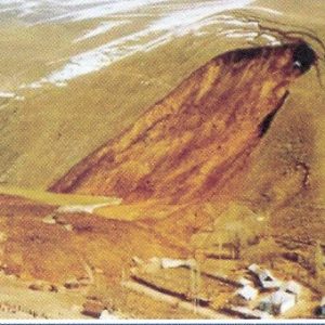
In the morning the route will continue to the Kochkor-Ata city. Excursion to landslides of Kochkor-Ata, the observation point34. In April 1994, on the slopes of the mountains, a landslide with a volume of 8-10 million m3 was formed. In the head part, the landslide has dimensions of up to 1 km. The height of the landslide formation ledge is about 30 meters. The landslide passed a distance of about 2 km. The thickness of the landslide masses is from 10 to 25 meters. (space photograph No. 4).
Arrival in Mailuu-Suu. Hotel accommodation.
Mailuu-Suu is a unique industrial city, which is located in mountainous conditions and is subject to very serious natural and man-made hazards.
In the geological structure of the surrounding mountains, Paleozoic limestones, shales, effusives, Jurassic clays, sandstones, coal layers participate; chalk clays, siltstones, Paleogene limestones, Paleogene-Neogene sandstones, clays, Neogene-Quaternary conglomerates, overlain by loess deposits.
The most dangerous and large landslides were formed around the Mailuu-Suu town . These landslides destroyed entire blocks, a factory, an infrastructure. Landslides occur in the Cretaceous-Paleogene deposits (K-P). More than 200 modern landslides were activated here. Ancient landslides occupy very large areas. The formation and activation of ancient landslides is associated with a large amount of precipitation, air temperature and fluctuations in groundwater levels. On 4 landslides, since 1954, continuous monitoring of the movement of landslides is carried out. In addition, some early landslide warning systems have been installed on some landslides.
All major landslides are confined to tectonic faults. The main reason for their occurrence is the rise in the water table. Overnight at the hotel.
Day 19. Excursion to the dinosaurs plateau and in the vicinity of the city.
In the morning, we will go to the dinosaur plateaus, where we will study the traces of the pterosaurus, and the geological structure of the surrounding mountains, the observation point 35. The plateau offers an excellent view of the city and the natural dangers that threaten the city.
From the plateau you can observe the geological and structural structure of the region. The ancient landslide slopes that surround the city create a continuous danger for residents and infrastructure of the city.
All major landslides Mailuu-Suu and Kochkor-Ata arose as a result of tectonic faults and groundwater. In addition, around the city there are many old mines, which also became conditions for landslides. Landslides in the Mailuu-Suu city, threaten uranium tailings. Destruction of tailings can ead to disaster and contamination of much of the Fergana valley.
Observation point 36, next to the destroyed factory “Isolate”. The landslide “Isolite” was formed in 1954 in the upper part of a large anticlinal fold. The volume of 300 thousand m3. The body of the landslide is composed of clays of Cretaceous age (K) with fragments of Paleogene limestones and loam. After lunch, tour to the upper part of the city.
Observation point 37. Landslide “Mine” was formed in 1953 on the body of an ancient landslide. It is located on the left bank of the Mailuu-Suu river opposite the landslide “Isolate” and is hanging over the building of the electrical lyceum. At present, the Lyceum is transferred to a safe place.
Observation point 38. The “North Karagach” landslide is on the right bank and threatens the residential of Karagach district. Later, the area was evacuated. The clay covering the limestone layer is involved in the movement. Displaced soils fall into the river Karagach, that is, a gradual unloading of the landslide occurs.
Observation point 39. Landslide “Koi-Tash”. The last 20 years is in an active state. Every year, a small displacement of ground masses was observed and destroyed the road. As a result of repair of the road, there were conditions for raising groundwater. On the inner side of the road, formed wetlands. In the spring of 1988, above the Koi-Tash village, a landslide with a length of 200 m was formed, which stopped at 100 m from residential buildings. 23 families were evacuated and new houses were allocated.
The reasons for the formation of the “Koi-Tash” landslide are atmospheric precipitation and rising groundwater levels. To stabilize the landslide, it is necessary to make groundwater drainage. This will make it possible to stop the movement of the frontal part of the landslide and to retain the shifting soils that are in the upper part of the slope. The landslide “Koi-Tash” and the landslide “Tectonics” threaten tailings.
Several tailing dumps with mining waste were transferred to safer sites. On the body of the Koi-Tash landslide, there are still residential buildings.
Excursion around the evacuated quarters of the city. Return to the hotel. In the evening, a seminar on the theme: landslides of the city Mailuu-Suu. The connection of large landslides with tectonic activity and the level of groundwater. Natural and technogenic situation in the city.
Day 20. Mailuu-Suu – Karakul – Toktogul reservoir.
On the way excursion to observation point 40. Regional Talas-Fergana tectonic rift. Accommodation in a guest house on the shore of the reservoir. In the evening, a seminar on the topic: Dangerous natural processes in Tien Shan and Pamir-Alai.
Day 21. Toktogul – Chichkan gorge – Suusamyr valley – Bishkek
The route passes along the beautiful Chichkan gorge. In the Chichkan and Suusamyr valley, study places with cryological processes, the observation point41. On the way excursion to the beautiful lake Itagar.
Lunch in Suusamyr valley. On the way to Bishkek, an excursion to observation point 42. Signs of active faults of the Suusamyr depression (the Tua-Ashu pass, 50 km from Bishkek).
Observation point 43. Change in the pattern of riverbeds (hydrological pattern), as a result of neotectonics (Tokoilu River valley, 20 km WNW Suusamyr).
Observation point 44. The eastern tectonic ledge, as a result of the Suusamyr earthquake of 7.3 Ms-1992-Suusamyr (162 km from the Bishkek-Osh road).
Observation point 45. Morphostructural changes in the relief after the Suusamyr earthquake, 7.3 Ms-1992-Suusamyr earthquake (km 166 Bishkek-Osh highway). Arrival in Bishkek. Hotel accommodation. In the evening a banquet.
Day 22. Transfer to the airport.
